

Altimeter 3D app for iPhone and iPad
Developer: Web-Dream
First release : 13 Dec 2013
App size: 15.67 Mb
Altimeter 3D
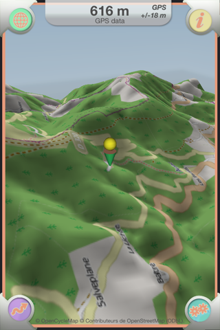
"Altimeter 3D" is an application which allows you to visualize all the surface of the earth in 3D, as well as to know the altitude at any place.
Ideal for hikers, bikers and skiers, this application allows you to see in 3D the difficulties of a course, to know the made uneven and the distances.
Several types of map are available. Map for hikers and bikers, map for skiers and standard topographic map.
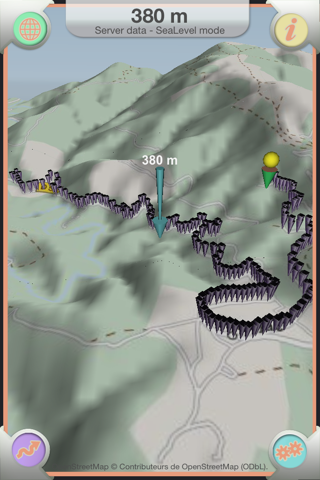
" Altimeter 3D" offers you the ability to save courses , view them as a graph and export data as images , text and CSV files.
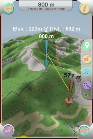
"Altimeter 3D" can also measure the distance and elevation between two places and to know your orientation with an embedded compass.
The elevation information is provided by servers of reliable data, either by the mobile GPS.
Maps are supplied by openstreetmap.org and her contributors under license ODBL.
Main characteristics:
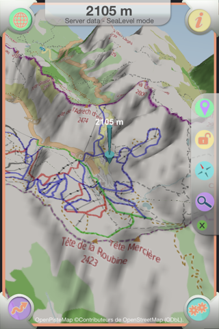
- 3D visualization of the entire surface of the earth.
- Ability to save maps before using the application in a place without internet connection.
- Showing elevation everywhere.
- Display distance and elevation between two places .
- Display speed during a course.
- Display GPS information.
- Automatic recording of course with manual positioning of WayPoint .
- Registration of course when the application is closed and / or mobile standby for increased energy savings .
- Display data paths in graph form ( Altitude - Speed ) .
- Export course in jpg format, text and CSV .
- Moving the map with one and two fingers.
- Automatic Map rotation, relative to the position of the mobile .
- Search address to get anywhere in the world.
- Altitude may be provided by GPS , or by data server .
- Altitude provided by the server in " sea level " mode or " ellipsoidal ".
- Unit of measure: meters , feet, miles.
- Compass embedded with magnetic or true north.
- 4 types of maps : hikers / bikers - Skiers - OpenStreet standard - Mapquest standard
- Showing the geographical position in degrees or degrees - minutes or degrees -minutes- seconds.
- Display horizontal and vertical accuracies .
Note: This app may use your location even when it isn’t open, which can decrease device battery life.
Warning: This application is not a measuring device, Web-Dream disclaims all liability during its use.